thomas
deckker
architect
Talks at Veretec
2022-23
2022-23
BBC: The Inquiry
BBC World Service 2019
BBC World Service 2019
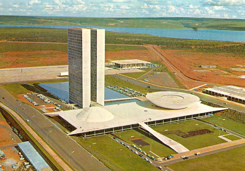
Brasília: Life Beyond Utopia
Brazil Institute, Kings College London 2016
Brazil Institute, Kings College London 2016
Brasília: Life Beyond Utopia
Architectural Design [April 2016]
Architectural Design [April 2016]
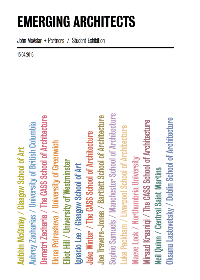
Two exhibitions for the McAslan Gallery
McAslan Gallery 2016
McAslan Gallery 2016
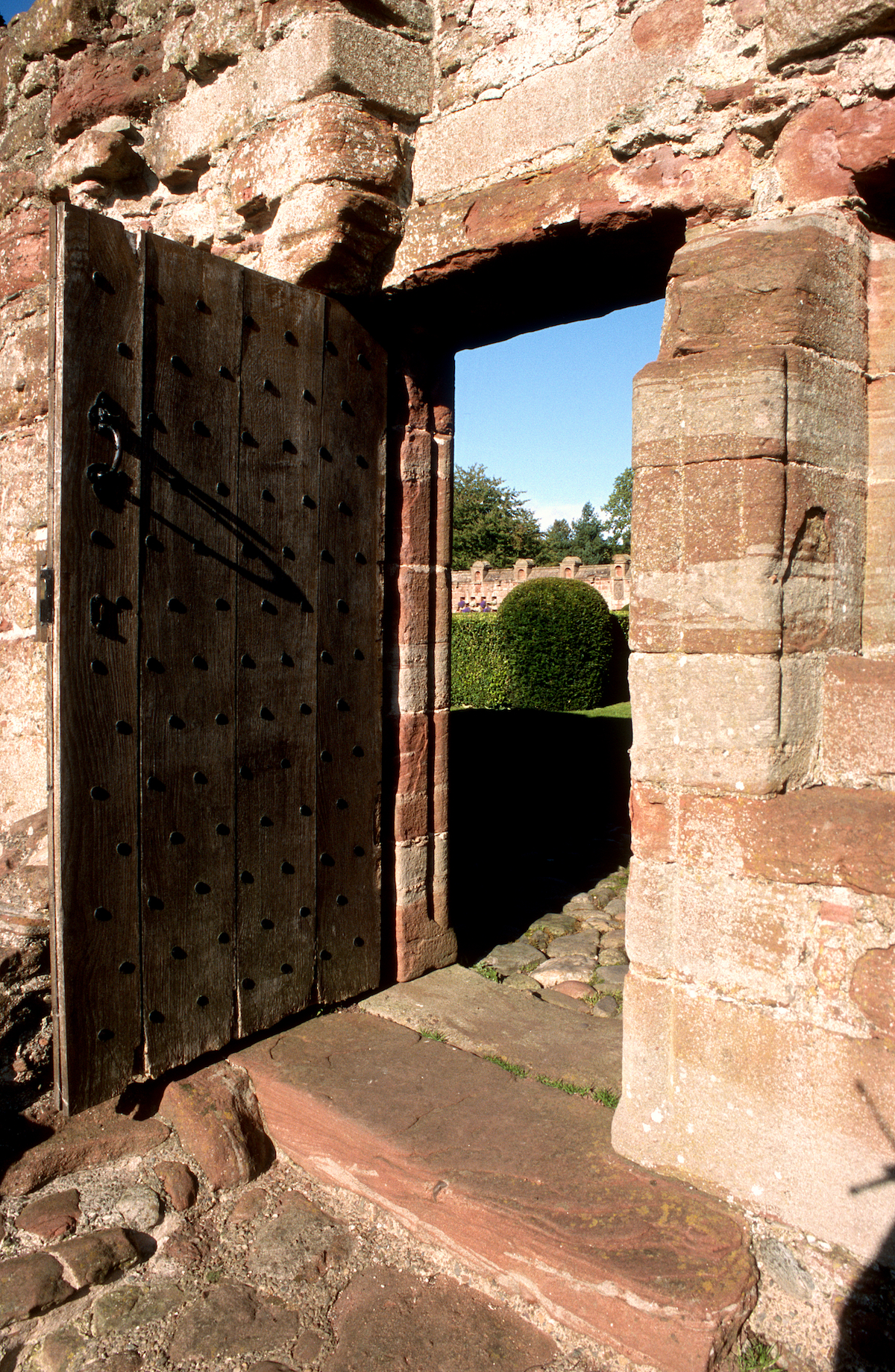
Edzell Castle: Architectural Treatises in Late 16th Century Scotland
Garden History Society 2014
Garden History Society 2014
Architecture and the Humanities
Architectural Research Quarterly 2014
Architectural Research Quarterly 2014
Urban Planning in Rio 1870-1930: the Construction of Modernity
Brazil Institute, Kings College London 2014
Brazil Institute, Kings College London 2014
Review of Remaking London: Design and Regeneration in Urban Culture
Architectural Research Quarterly 2013
Architectural Research Quarterly 2013
Life's a Beach: Oscar Niemeyer, Landscape and Women
The Rest is Noise Festival
South Bank, London 6 October 2013
The Rest is Noise Festival
South Bank, London 6 October 2013
BBC: Last Word
BBC Radio 4 7 & 9 December 2012
BBC Radio 4 7 & 9 December 2012
Brasilia: Fictions and Illusions
Brazil Institute, Kings College London 2012
Brazil Institute, Kings College London 2012
Connected Communities Symposium
University of Dundee 2011
University of Dundee 2011
Architecture + ESI: an architect's perspective
FESI [The UK Forum for Engineering Structural Integrity] 2011
FESI [The UK Forum for Engineering Structural Integrity] 2011
Review of Mapping London
Architectural Research Quarterly 2010
Architectural Research Quarterly 2010
The Studio of Antonio Carlos Elias
Epulis Fissuratum [Brasília 2006]
Epulis Fissuratum [Brasília 2006]
Urban Entropies: A Tale of Three Cities
Architectural Design [September 2003]
Architectural Design [September 2003]
New Architecture in Brazil
- Photographs by Michael Frantzis
Brazilian Embassy, London
5-6 March 2003
- Photographs by Michael Frantzis
Brazilian Embassy, London
5-6 March 2003
Natural Spirit (Places to Live 007)
Wallpaper* [January/February 2003]
Wallpaper* [January/February 2003]
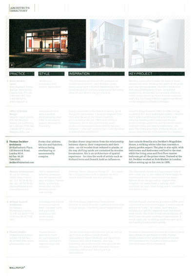
Architects Directory
Wallpaper* [July/August 2002]
Wallpaper* [July/August 2002]
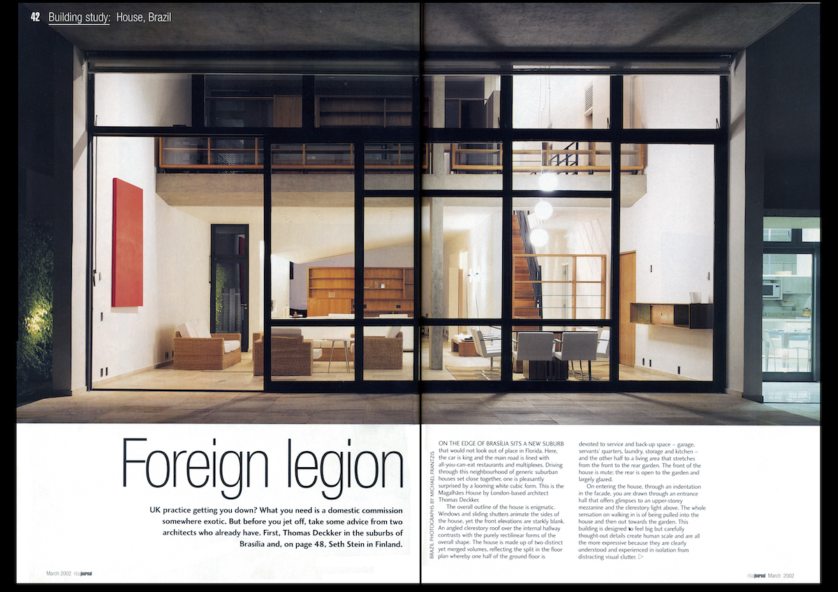
Foreign LegionRIBA Journal [March 2002]
Architects and Technology
The Encyclopaedia of Architectural Technology [London: Wiley 2002]
The Encyclopaedia of Architectural Technology [London: Wiley 2002]
Mexican-American Architecture
Mexican-American Encyclopaedia [2002]
Mexican-American Encyclopaedia [2002]
In the Realm of the Senses
Architectural Design [July 2001]
Architectural Design [July 2001]
Thomas Deckker: Two Projects in Brasília
Architectural Design [Oct 2000]
Architectural Design [Oct 2000]
First International Seminar on the Teaching of the Built Environment [SIEPAC]
University of São Paulo, Brazil
13-15 Sept 2000
University of São Paulo, Brazil
13-15 Sept 2000
Issues in Architecture Art & Design
vol. 6 no. 1 [University of East London 2000]
vol. 6 no. 1 [University of East London 2000]
Monte Carasso: The re-invention of the site
Issues in Architecture Art& Design vol. 5 no. 2 [University of East London 1998]
Issues in Architecture Art& Design vol. 5 no. 2 [University of East London 1998]
Specific Objects / Specific Sites
Rethinking the Architecture / Landscape Relationship, University of East London,
26-28 Mar 1996
Rethinking the Architecture / Landscape Relationship, University of East London,
26-28 Mar 1996
Herzog & deMeuron
Issues in Architecture Art & Design vol. 3 no. 2 [University of East London 1994]
Issues in Architecture Art & Design vol. 3 no. 2 [University of East London 1994]
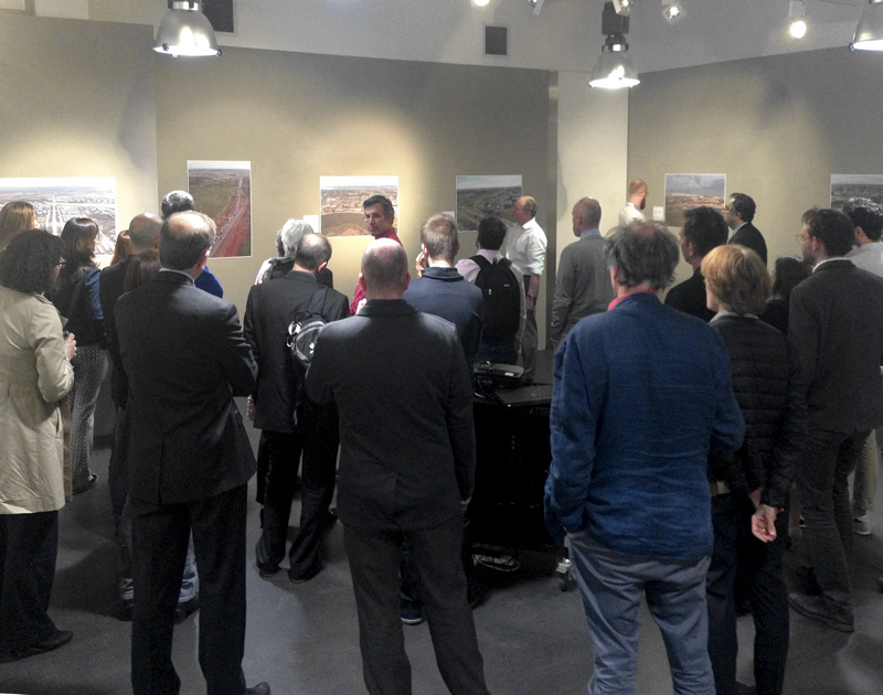
McAslan Gallery: Urban Transformations in Brazil
Curator: Thomas Deckker
Curator: Thomas Deckker
Brasília: Life Beyond Utopia
McAslan Gallery, London
2016
This exhibition accompanied the publication of a special issue of Architectural Design on sustainable urban planning edited by Hattie Hartman.
Photographs by Joana França
Texts by Thomas Deckker

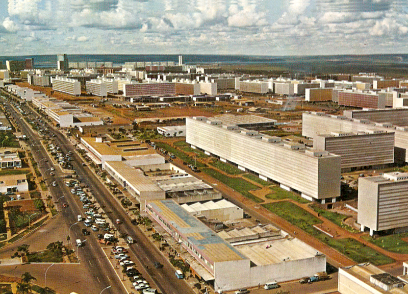
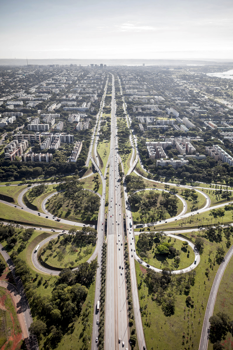
Aerial View of Brasília, Distrito Federal, 2013
Superquadras looking north from the southwestern end of the asa sul [south wing]. The original city was dominated by its road layout, in keeping with contemporary ideals of the private car. The resemblance to the ideal city that formed the centrepiece of the General Motors Futurama pavilion at the New York Worlds Fair 1939, which Lúcio Costa saw while building the Brazilian Pavilion, is clear.
Superquadras looking north from the southwestern end of the asa sul [south wing]. The original city was dominated by its road layout, in keeping with contemporary ideals of the private car. The resemblance to the ideal city that formed the centrepiece of the General Motors Futurama pavilion at the New York Worlds Fair 1939, which Lúcio Costa saw while building the Brazilian Pavilion, is clear.
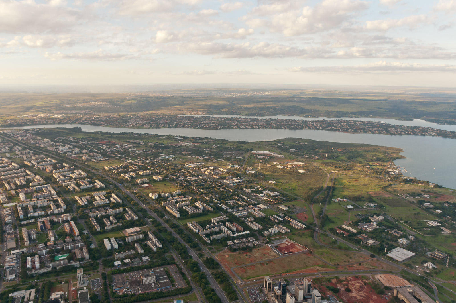
Aerial View of Brasília, Distrito Federal, 2009
Superquadras looking north from the Eixo Monumental [Government Axis], approximately halfway along the 13km main axis. The campus of the University of Brasília lies on the near lakeside; on the far side is the Setor Habitacional Individuais Norte [North Lake Residential Sector], private houses based on Ludwig Hilbersheimer's The New Regional Pattern of 1949. The 'New Regional Pattern' was an utopian suburb based on cul-de-sacs and parkways.
Superquadras looking north from the Eixo Monumental [Government Axis], approximately halfway along the 13km main axis. The campus of the University of Brasília lies on the near lakeside; on the far side is the Setor Habitacional Individuais Norte [North Lake Residential Sector], private houses based on Ludwig Hilbersheimer's The New Regional Pattern of 1949. The 'New Regional Pattern' was an utopian suburb based on cul-de-sacs and parkways.
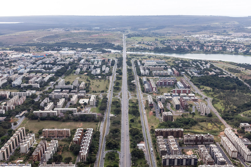
Aerial View of Brasília, Distrito Federal, 2013
The northern end of the main residential axis, 13 km from the southern end shown in the first photograph. The entrance to the Setor Habitacional Individuais Norte [North Lake Residential Sector] lies across the lake. It is important to recognise that the superquadras here bear only a intentionally superficial resemblance to the original utopian designs of Lúcio Costa, as the contemporary reality of condomínios fechados, or secure gated enclaves, meets the World Heritage status of Costa's plan.
The northern end of the main residential axis, 13 km from the southern end shown in the first photograph. The entrance to the Setor Habitacional Individuais Norte [North Lake Residential Sector] lies across the lake. It is important to recognise that the superquadras here bear only a intentionally superficial resemblance to the original utopian designs of Lúcio Costa, as the contemporary reality of condomínios fechados, or secure gated enclaves, meets the World Heritage status of Costa's plan.
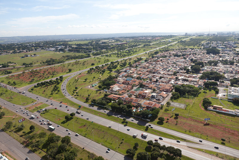
Aerial View of the Eixo Monumental, Distrito Federal, 2011
The western end of the Eixo Monumental [Government Axis], with the Estrada Parque Indústria e Abastecimento [Industry and Warehouse Parkway] at the bottom of the photograph. This settlement in the foreground, Cruzeiro, was one of the first low- income areas of the city, begun in 1958 shortly after construction began on the official city, in a popular style of loteamentos [subdivisions].
The western end of the Eixo Monumental [Government Axis], with the Estrada Parque Indústria e Abastecimento [Industry and Warehouse Parkway] at the bottom of the photograph. This settlement in the foreground, Cruzeiro, was one of the first low- income areas of the city, begun in 1958 shortly after construction began on the official city, in a popular style of loteamentos [subdivisions].
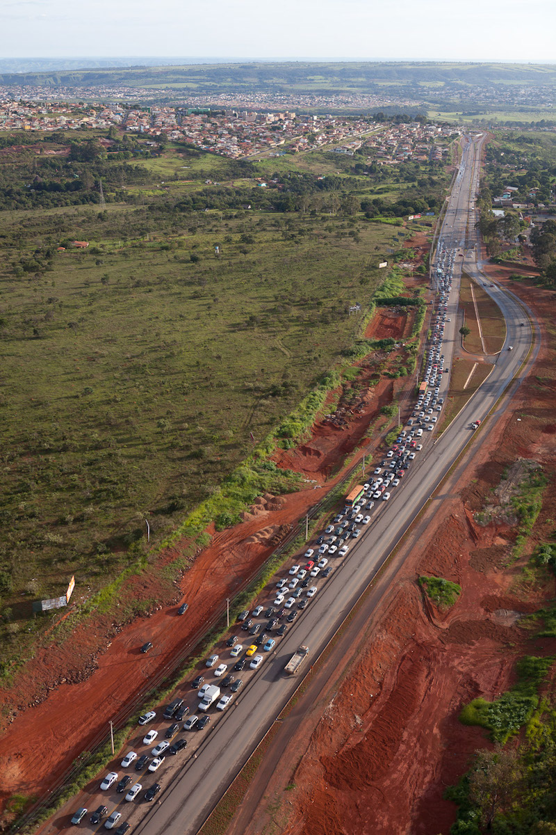
Aerial View of Estrada Parque Indústria e Abastecimento, Distrito Federal, 2011
The Estrada Parque Indústria e Abastecimento [Industry and Warehouse Parkway] originally formed the the western extremity of Brasília, where the industrial and warehouse sectors were planned. While these sectors still exist they have been enlarged by massive new residential areas. This road links virtually all the satellite cities together, as well as linking them to Brasília, so is very heavily trafficked.
The Estrada Parque Indústria e Abastecimento [Industry and Warehouse Parkway] originally formed the the western extremity of Brasília, where the industrial and warehouse sectors were planned. While these sectors still exist they have been enlarged by massive new residential areas. This road links virtually all the satellite cities together, as well as linking them to Brasília, so is very heavily trafficked.
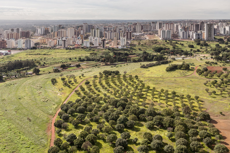
Aerial View of Águas Claras, Distrito Federal, 2011
There are still Environmental Protection Areas separating Brasília from the satellite cities, although vestigial in places. The pristine nature of this 'area verde' [green belt] is deceptive, as the official residence of the Governor of the Distrito Federal lies just out of site on the bottom left of the photograph. The destruction of the green belt in Brasília is a warning to its potential destruction in London.
There are still Environmental Protection Areas separating Brasília from the satellite cities, although vestigial in places. The pristine nature of this 'area verde' [green belt] is deceptive, as the official residence of the Governor of the Distrito Federal lies just out of site on the bottom left of the photograph. The destruction of the green belt in Brasília is a warning to its potential destruction in London.
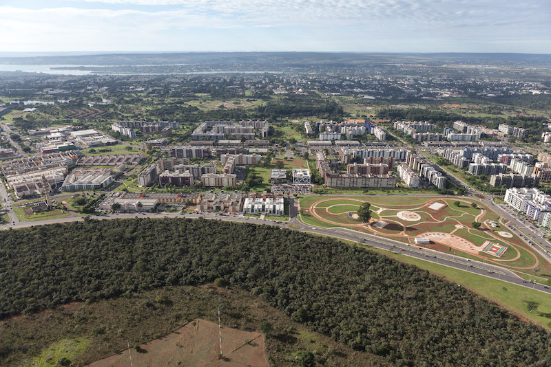
Aerial View of Environmental Protection Area and the Southwest Sector, 2013
A view encompassing 4 distinct areas in Brasília, looking across instead of along the main residential axis: in the front, the Área de Proteção Ambiental [green belt], then the Setor Sudoeste [Southwest Sector], a recent development doubling the size of the south wing of the city, then before the lake, the superquadras of the asa sul [south wing], and in the far distance the Setor Habitacional Individuais Sul [South Lake Residential Sector], based on Ludwig Hilbersheimer's The New Regional Pattern of 1949.
A view encompassing 4 distinct areas in Brasília, looking across instead of along the main residential axis: in the front, the Área de Proteção Ambiental [green belt], then the Setor Sudoeste [Southwest Sector], a recent development doubling the size of the south wing of the city, then before the lake, the superquadras of the asa sul [south wing], and in the far distance the Setor Habitacional Individuais Sul [South Lake Residential Sector], based on Ludwig Hilbersheimer's The New Regional Pattern of 1949.
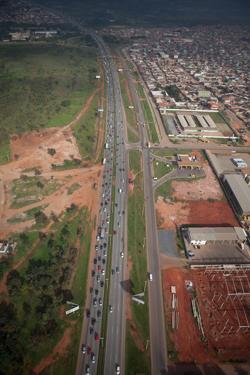
Aerial View of the Via Estrutural, Distrito Federal, 2013
The Via Estrutural, or the Estrada Parque Ceilândia [Ceilândia Parkway] is the major road linking the satellite cities of Ceilândia and Taguatinga to the western extremity of Brasília. So great is the flow of traffic that the entire road is one way (into Brasília in the morning, and out in the evening).
The Via Estrutural, or the Estrada Parque Ceilândia [Ceilândia Parkway] is the major road linking the satellite cities of Ceilândia and Taguatinga to the western extremity of Brasília. So great is the flow of traffic that the entire road is one way (into Brasília in the morning, and out in the evening).
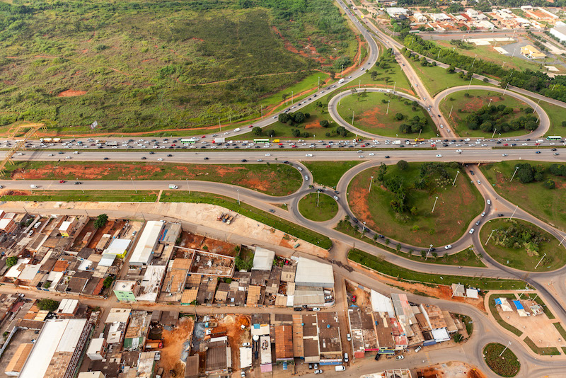
Aerial View of the Via Estrutural, Distrito Federal, 2013
The invasion in the foreground, the Vila Estrutural, was regularised in 2004. Vila Estrutural. It is officially part of the Setor Indústria e Abastecimento [Industry and Warehouse Sector]. Invasions generally have no official water, sewage, education or health provision, and fight for regularisation, or recognition by the Government of the Distrito Federal, after construction.
The invasion in the foreground, the Vila Estrutural, was regularised in 2004. Vila Estrutural. It is officially part of the Setor Indústria e Abastecimento [Industry and Warehouse Sector]. Invasions generally have no official water, sewage, education or health provision, and fight for regularisation, or recognition by the Government of the Distrito Federal, after construction.
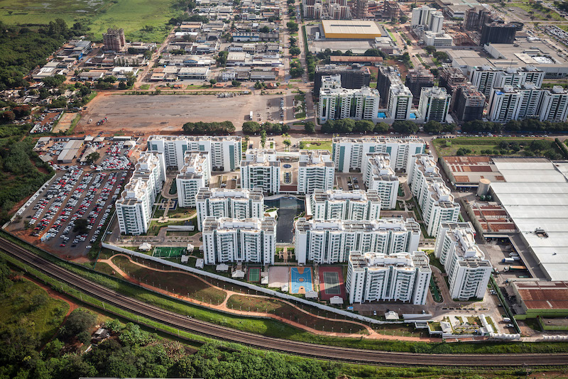
Aerial View of Gated Enclave, Shopping, Distrito Federal, 2013
The condomínio fechado, or secure gated enclave, is now the most common form of middle-class residential development in the Distrito Federal, in contrast to the open and communitarian city envisaged by Lúcio Costa. This example is located on unregulated land close to ParkShopping, the suburban shopping mall built in 1983 that led to the decline of central shopping areas in Brasília but which has since formed the nucleus of further suburban development.
The condomínio fechado, or secure gated enclave, is now the most common form of middle-class residential development in the Distrito Federal, in contrast to the open and communitarian city envisaged by Lúcio Costa. This example is located on unregulated land close to ParkShopping, the suburban shopping mall built in 1983 that led to the decline of central shopping areas in Brasília but which has since formed the nucleus of further suburban development.
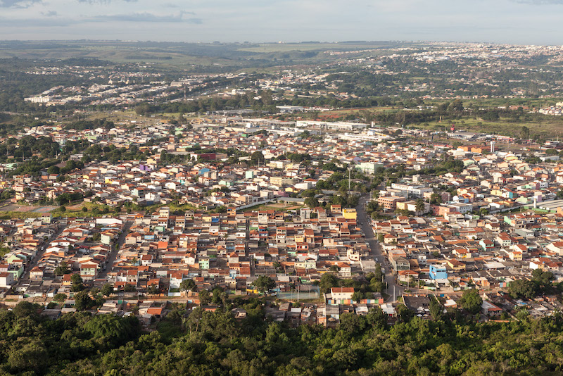
Aerial View of Núcleo Bandeirante, Distrito Federal, 2011
Núcleo Bandeirante [Pioneer Settlement] was the first deviation form the official plan for the Distrito Federal [Federal District], originally established as a workers' camp well before the inauguration of the city in 1961. It is now an established suburb.
Núcleo Bandeirante [Pioneer Settlement] was the first deviation form the official plan for the Distrito Federal [Federal District], originally established as a workers' camp well before the inauguration of the city in 1961. It is now an established suburb.
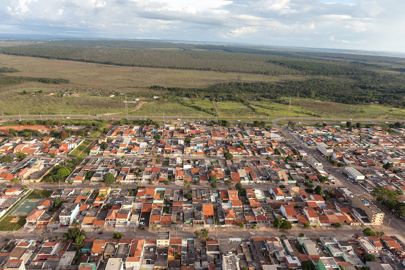
Aerial View of Taguatinga, Distrito Federal, 2011
Taguatinga was the first satellite city, underway within a year of work starting on the official Plano Piloto [Pilot Plan] in 1957. The original utopian architecture, based on migrant worker housing designed by Walter Gropius and Marcel Breuer for the US Works Progress Administration in 1944, barely survived the period of initial construction and was replaced by subdivisions promoted by the United States Agency for International Development, part of the the anti-communist Alliance for Progress created by President Kennedy in 1961. The most recent expansion is by low-income loteamentos [subdivisions], typical of Brazilian rural cities.
Taguatinga was the first satellite city, underway within a year of work starting on the official Plano Piloto [Pilot Plan] in 1957. The original utopian architecture, based on migrant worker housing designed by Walter Gropius and Marcel Breuer for the US Works Progress Administration in 1944, barely survived the period of initial construction and was replaced by subdivisions promoted by the United States Agency for International Development, part of the the anti-communist Alliance for Progress created by President Kennedy in 1961. The most recent expansion is by low-income loteamentos [subdivisions], typical of Brazilian rural cities.
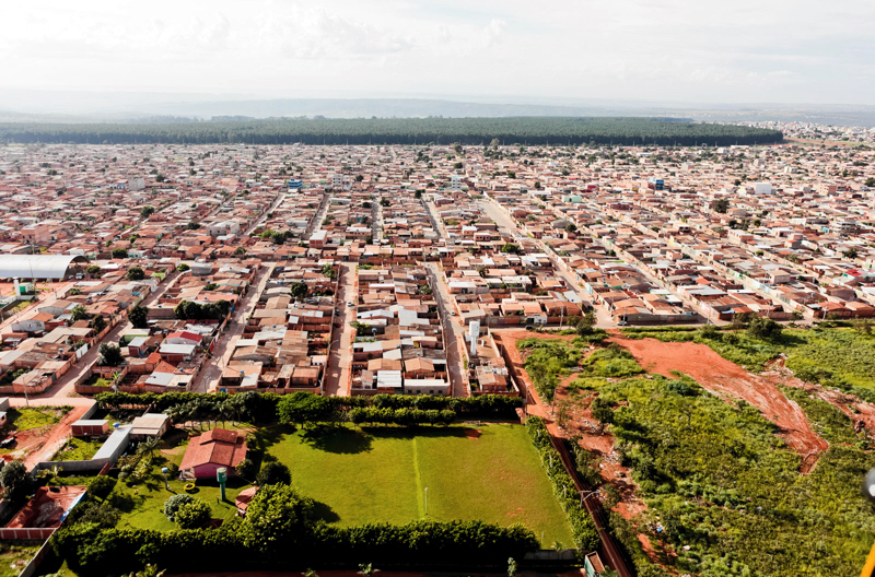
Aerial View of Itapoã, Distrito Federal, 2011
Vast areas of low-income loteamentos [subdivisions] have sprung up in the Distrito Federal, without employment, transport or services. Itapoã is an irregular settlement 22 kilometres from Brasília in the rural northeastern sector.
Vast areas of low-income loteamentos [subdivisions] have sprung up in the Distrito Federal, without employment, transport or services. Itapoã is an irregular settlement 22 kilometres from Brasília in the rural northeastern sector.
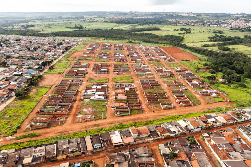
Aerial View of Setor Habitacional Buritis, Sobradinho II, Distrito Federal, 2011
Aerial View of Setor Habitacional Buritis, Sobradinho II, Distrito Federal, 2011 It may be surprising that the official construction of low-income housing is in loteamentos [subdivisions]. Buritis is a new residential sector in Sobradinho II, 19 kilometres from Brasilia in the rural northeastern sector. This residential sector in the popular style of loteamentos [subdivisions] is by the official government agency Companhia de Desenvolvimento Habitacional DF [Residential Development Agency of the Federal District], part of the 'Minha Casa Minha Vida' [My House My Life] programme.
Aerial View of Setor Habitacional Buritis, Sobradinho II, Distrito Federal, 2011 It may be surprising that the official construction of low-income housing is in loteamentos [subdivisions]. Buritis is a new residential sector in Sobradinho II, 19 kilometres from Brasilia in the rural northeastern sector. This residential sector in the popular style of loteamentos [subdivisions] is by the official government agency Companhia de Desenvolvimento Habitacional DF [Residential Development Agency of the Federal District], part of the 'Minha Casa Minha Vida' [My House My Life] programme.
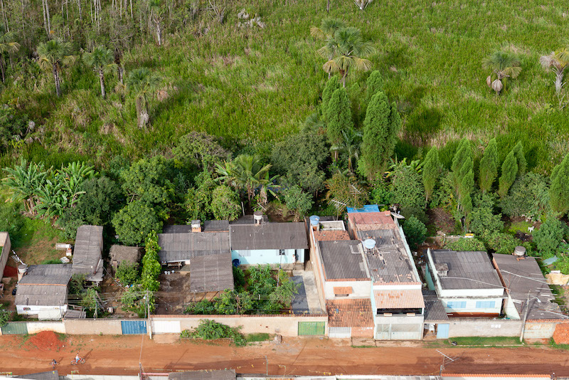
Aerial View of Setor Habitacional Buritis, Sobradinho II, Distrito Federal, 2011
Many migrants to the Distrito Federal are too poor for the official the 'Minha Casa Minha Vida' [My House My Life] programme built and financed by the official government agency Companhia de Desenvolvimento Habitacional DF [Residential Development Agency of the Federal District]. This invasion is in an Área de Proteção Ambiental [green belt] in Sobradinho II, 19 kilometres from Brasilia in the rural northeastern sector.
Many migrants to the Distrito Federal are too poor for the official the 'Minha Casa Minha Vida' [My House My Life] programme built and financed by the official government agency Companhia de Desenvolvimento Habitacional DF [Residential Development Agency of the Federal District]. This invasion is in an Área de Proteção Ambiental [green belt] in Sobradinho II, 19 kilometres from Brasilia in the rural northeastern sector.
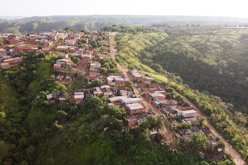
Aerial View of Invasion, Vila Rabêlo, Distrito Federal, 2011
The form of the invasion mirrors that of the favelas in Rio, built into the hillsides which circumscribe the beautiful valley in which Brasília is located. This invasion is virtually a suburb of the satellite city Sobradinha, 19 kilometres from Brasilia in the rural northeastern sector.
The form of the invasion mirrors that of the favelas in Rio, built into the hillsides which circumscribe the beautiful valley in which Brasília is located. This invasion is virtually a suburb of the satellite city Sobradinha, 19 kilometres from Brasilia in the rural northeastern sector.
